About Us
Aerial Topographic Services (P) Ltd (ATS) is a company specializing in photogrammetric digital mapping. Essentially it is an international company, we consist of three nationalities and our offices are located in three countries. We are a team of energetic passionate people, each of us with 4 to 27 years of experience in all phases of photogrammetry and GIS.
Our Mission
To provide our clients with professional, cost-effective photogrammetric services in accordance with their specific requests and ASPRS mapping accuracy standards. Aerial Topographic Services (P) Ltd guarantees complete customer satisfaction.
Our Software
In order to meet the highest possible quality standards of our photogrammetric services we invested in one of the best software DAT/EM and Inpho products and hardware available in the market. Also we perform a thorough quality control check before delivering products to the clients. There is not a project too big or too small for us. We treat every single one with appropriate care and attention. If requested by the client, we produce and deliver a pilot model prior to commencing full production to ensure that all instructions are understood and correctly implemented. Unless it is a very small project of one or two days of work, we always e-mail detailed status reports to the client on a daily basis
Deliverables promised are Delivered In-time, Immaculately and Professionally. ATS comprises of efficient and enthusiastic staff from 4 to 27 years experience and is equipped with robust and up-to-date equipment, which allows production in a completely digital environment to deliver a high quality production facility to our clients. Our inclination towards technology allows us to offer quality and cost-effective mapping solutions with prompt production schedules. Our working capacities allows our clients to have detailed and deep level knowledge of the project status, our Project Managers have complete assessment and control of the projects, there by providing regular updates to the clients, this ensures that problems, if any, are identified, resolved and avoided early and in-time for efficient completion and delivery of the Projects to client's satisfaction.
Our Team
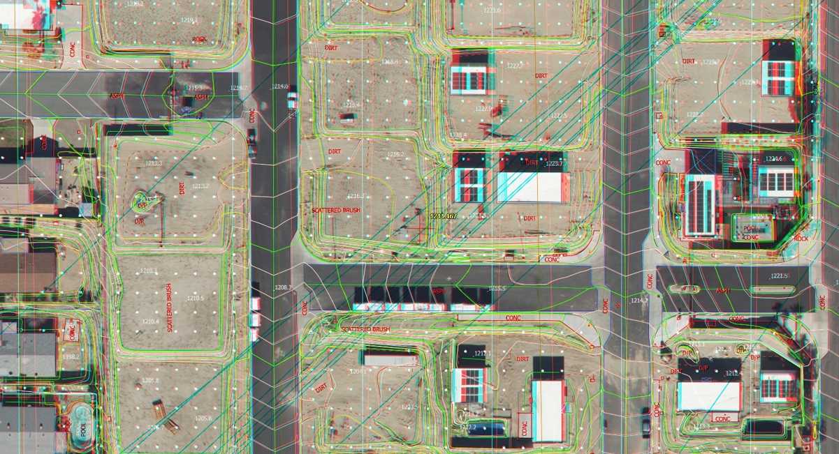
Aerial Triangulation
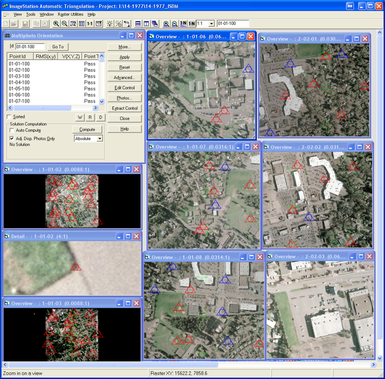
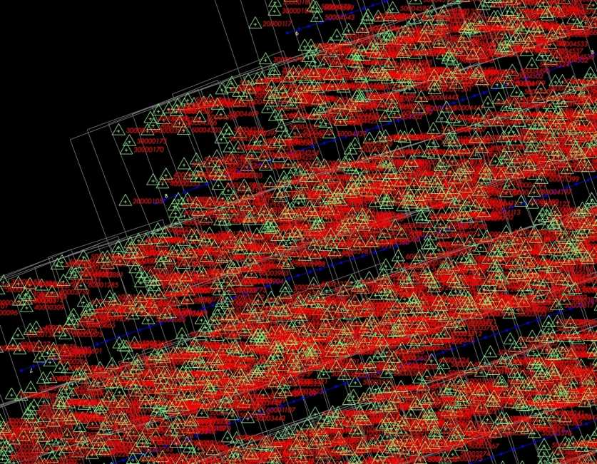
Aerial triangulation is a mathematical process used to determine the position and orientation of each photograph at the moment of exposure. Aerial triangulation solves for each photo’s exterior orientation parameters, which convey the information necessary to convert image measurements into ground coordinates, as well as determine image points that correspond to points on the ground. Knowledge of the orientation parameters enables photogrammetric principles to be applied to planimetric and topographic map compilation, orthophoto production, digital terrain model editing and creation, and other important support tasks. Our aerial triangulation software supports both softcopy and analytical aerial triangulation, and incorporates airborne GPS/IMU data to constrain and guide the process.
Our in-house experts have written proprietary software to aid in the aerial triangulation process. One program, which we use as part of our standard workflow, performs image point corrections for radial and decentering lens distortions. This practice is not an industry standard, as most off-the-shelf aerial triangulation software packages only correct for radial lens distortions. Photo scale, camera/film characteristics, flight line configuration, ground control layout, GPS/IMU availability, and sometimes the terrain play a role in the accuracy of aerial triangulation. ATS’s policy requires at least two aerial triangulation specialists to validate results before considering the task complete. Redundant control information, statistical analysis, and subsequent quality checks all enable us to provide reliable results.
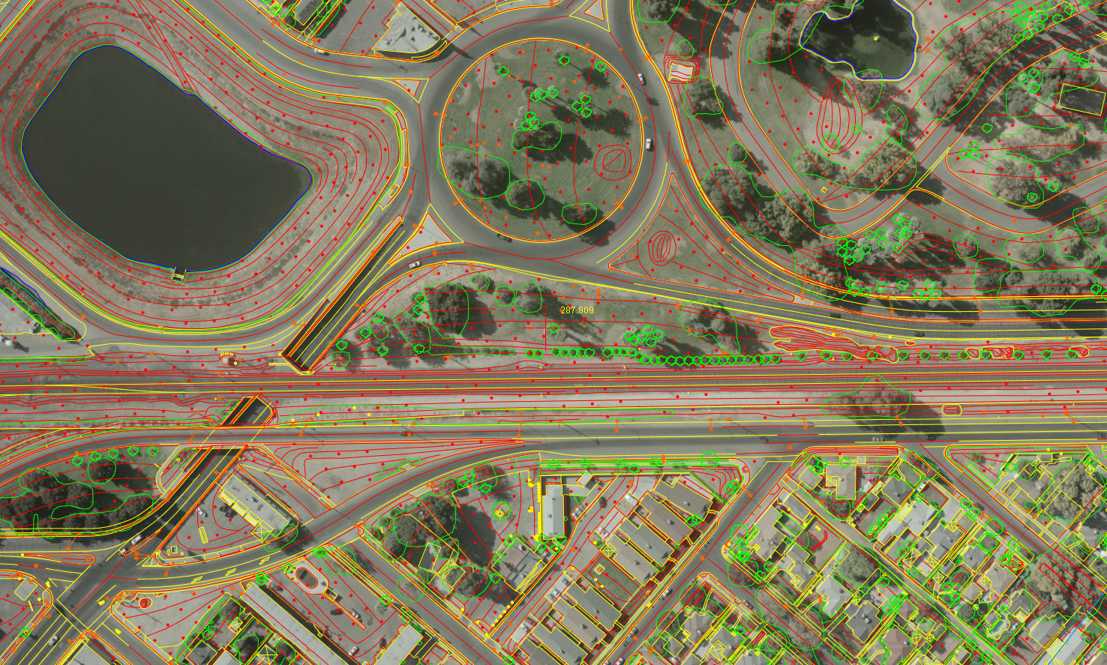
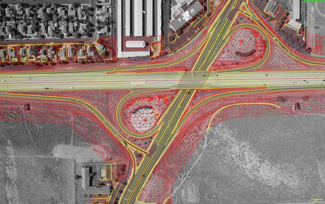
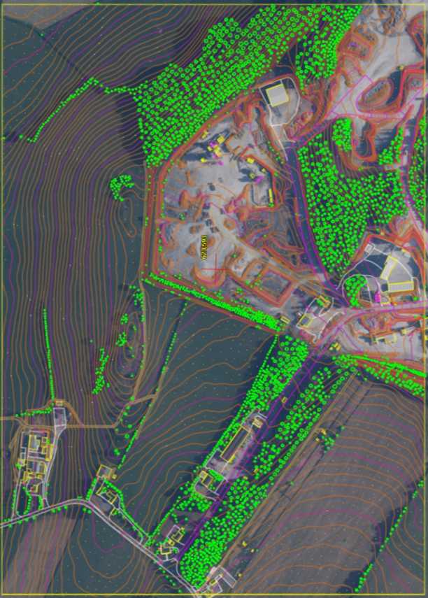
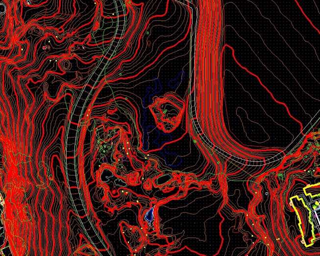
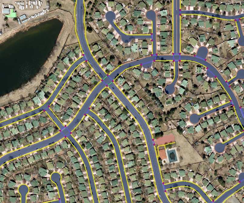
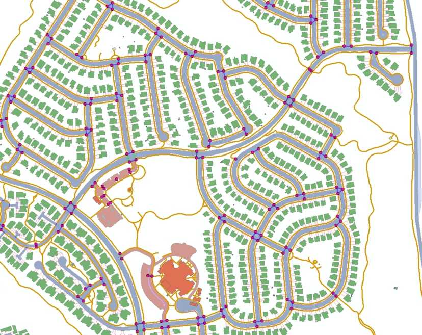
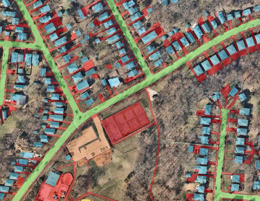
Digital Mapping
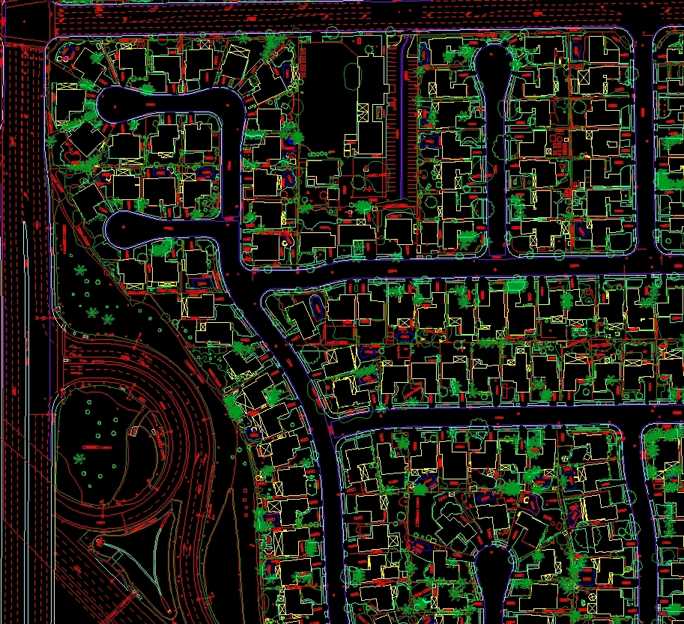
Stereo digitizing is performed on DAT/EM Summit evolution, LPS and ImageStation SSK digital photogrammetric workstations. These workstations utilize Microstation /AutoCAD mapping software, which provides a superior, easy to use, map feature digitizing system for use with stereo scanned imagery. These workstations allow for efficient, accurate data collection while allowing for the ability to easily customize the data to individual client needs (format, layering, symbology, etc.). We are capable of handling any imagery from digital photogrammetric cameras like Vexcel, DMC or ADS 40/50.
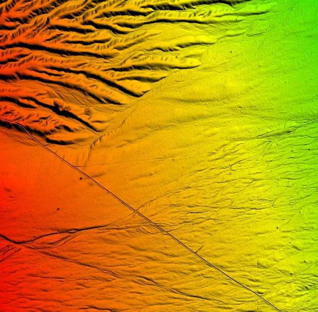
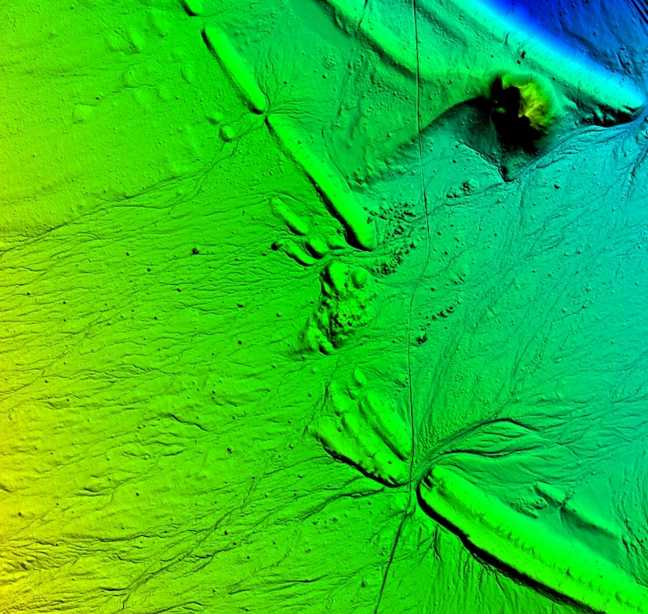
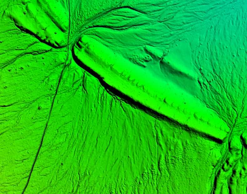
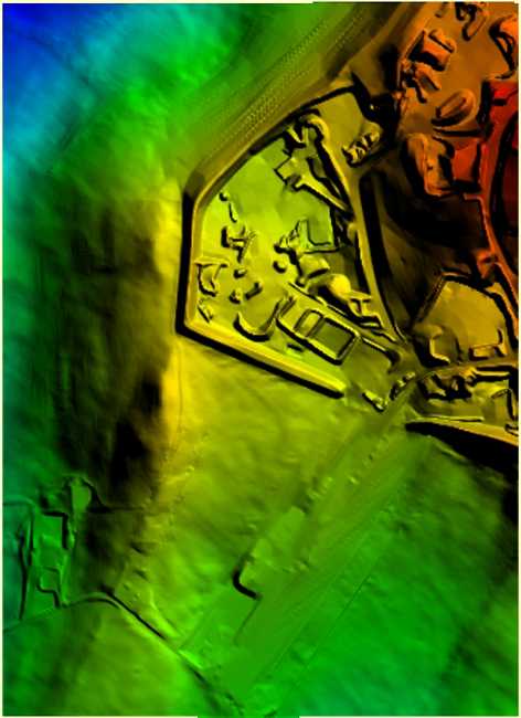
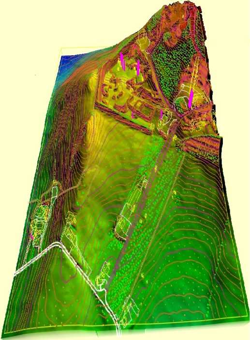
Digital Terrain Modelling
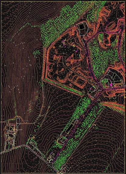
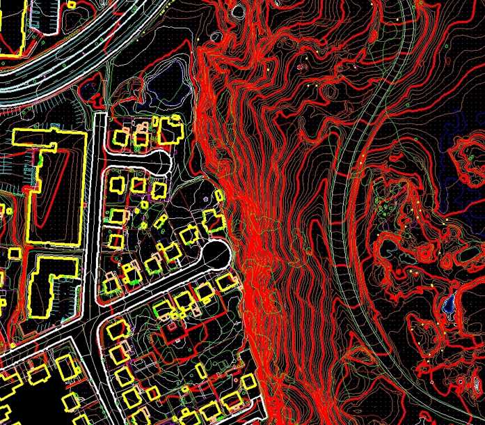
A digital terrain model (DTM) is the basis for all contouring, orthophoto, TIN calculations and other surface modelling. The DTMs collected on the Match-T/DATEM workstations are comprised of mass points and breaklines; which delineate various terrain defining features, such as ravines, ridges, tops and toes of slopes, as well as mass elevation grid points used in flatter areas. Unless client specified, ATS always collects a full DTM on every project in order to provide the most accurate surface model possible in order to meet and exceed ASPRS standards Feature Collection is the process of collecting non-surface, or cultural, terrain features within the stereo-model, such as curb-lines, building footprints, transportation lines, vegetation and the like. All discernible planimetric features are collected and digitized in conformance with each client's CAD standards for data parameters such as layering, line-weight, line-type and entity color. ATS stereo compilers employ 3D digitizing techniques to trace, or pinpoint, features. Digitized features are joined visually as well as digitally with no edge match tolerance.
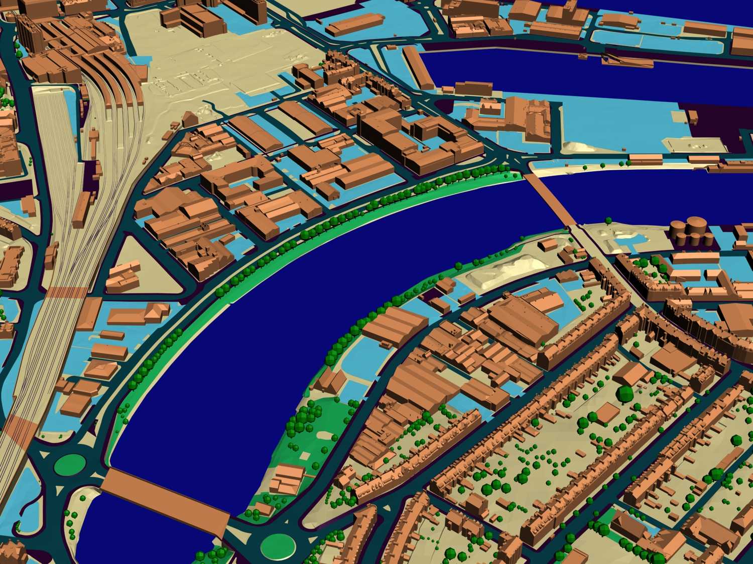
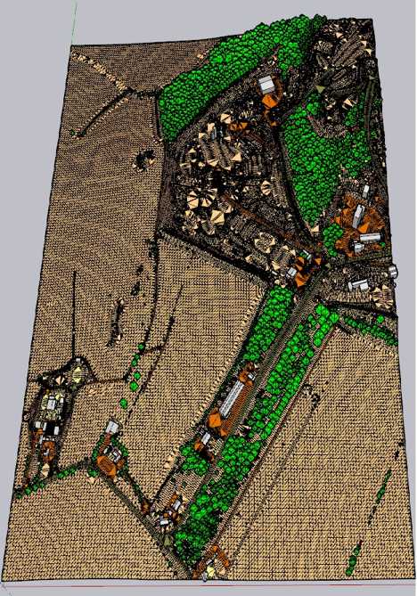
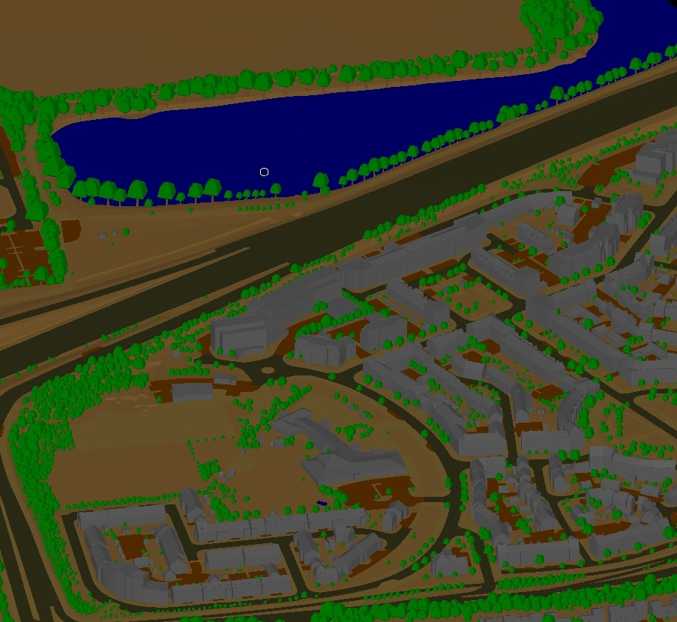
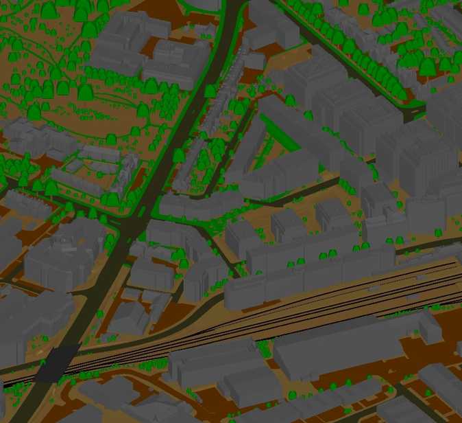
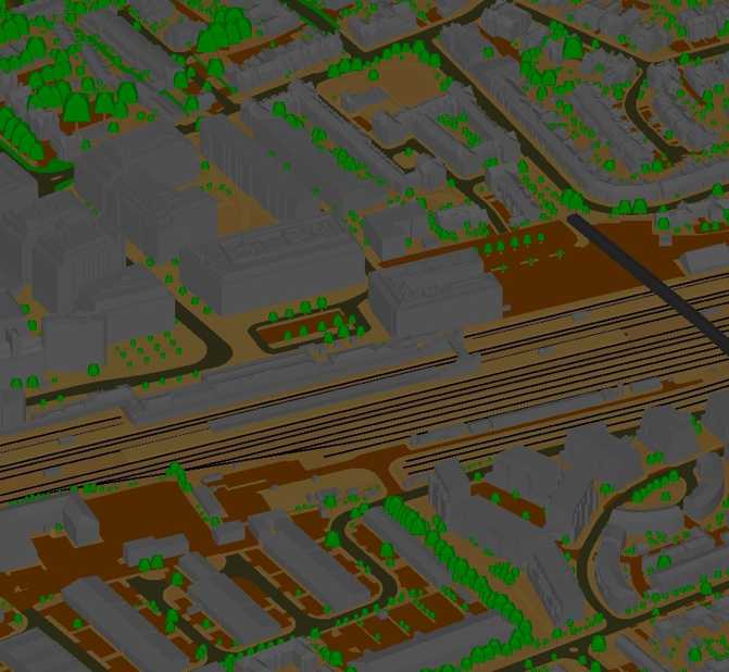
3D Modelling
An efficient and highly useful tool in urban planning is the 3D city model. It can provide urban planners as well as the public with an easy and comprehensible illustration of e.g. major future construction projects. ATS develops 3D city models of various urban structures. The 3D city models are created on the basis of already established basic maps like orthophotos and height models and can be used for 3D visualization of new building- or infrastructure projects.
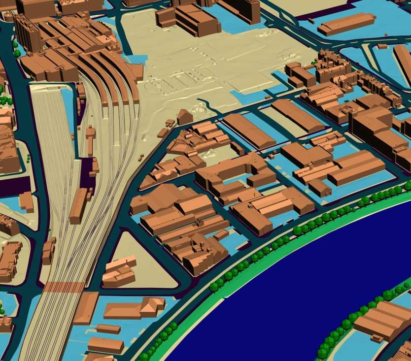
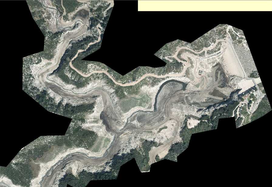
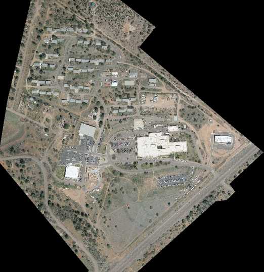
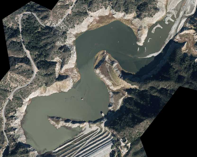
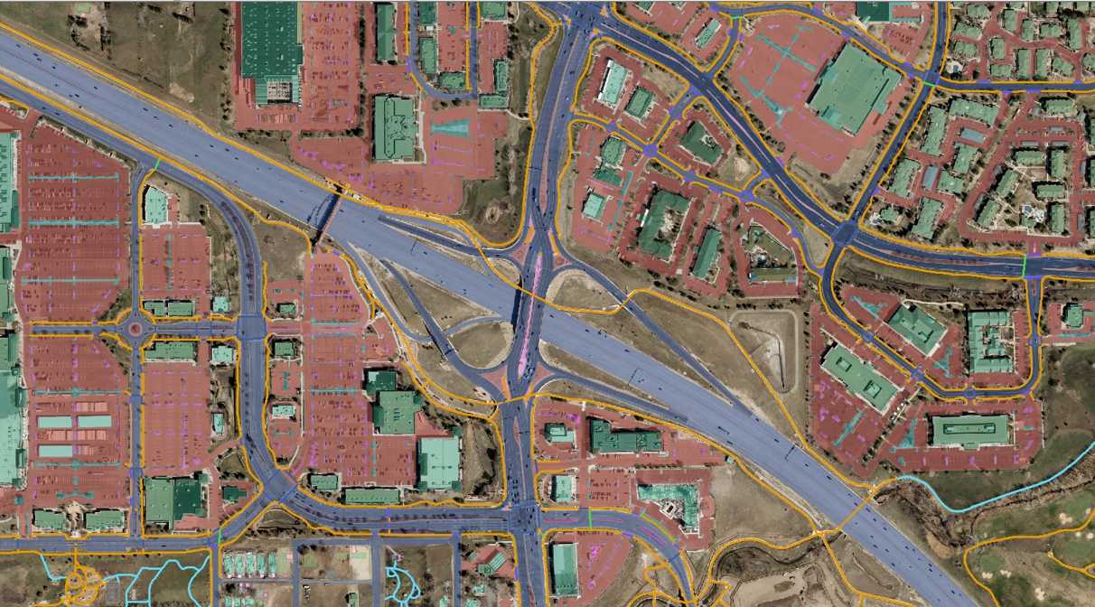
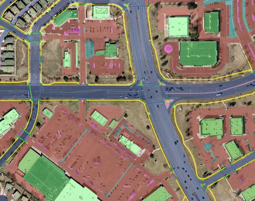
Ortho Photo Mosaic
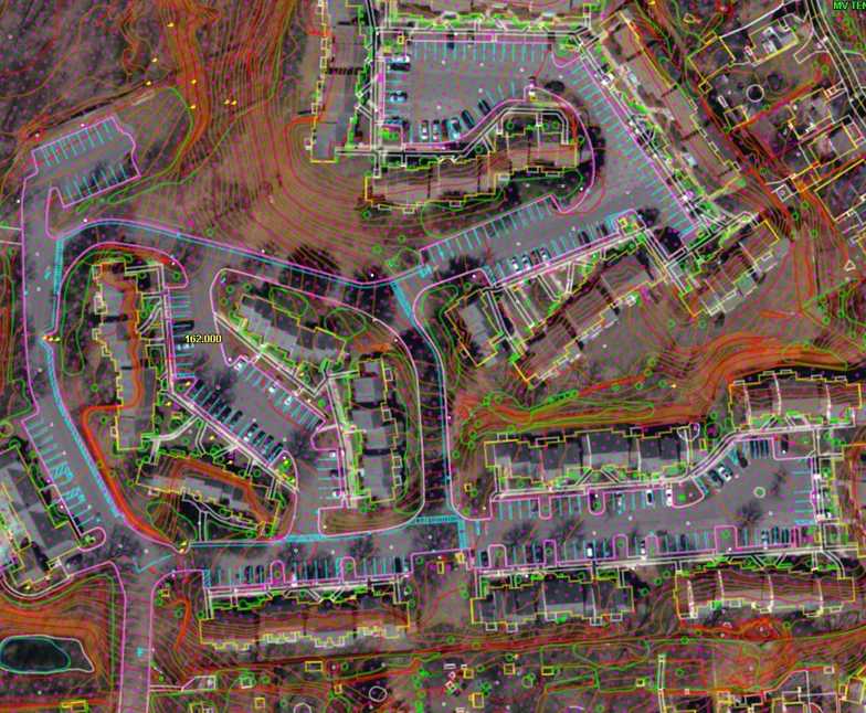
Digital orthophotos are becoming more and more popular and widely used. They serve as an efficient tool in fields like transport planning, land use planning and natural resource planning. Digital orthophotos are aerial photographs, which are rectified for tilt, relief and other systematic errors from perspective projection. A digital orthophoto represents ground features in their "true map positions" via a raster image.
GIS
With many years of research and real life experience in all territories in the GIS domain, we provide successful and accurate execution of your GIS related projects. For any research project, the essential and important point with mapping is registering a map with the correct real world coordinates. If the maps are not georeferenced, no other information can be displayed over or positioned under the map coverage. With our GIS services, we offer accurate georeferencing / geocoding of your projects at affordable prices. We are capable of various geospatial analytical procedures for users in agriculture, fisheries, market research, transport, electrical network, banking water supplies, sewage, forestry, flood management, hazard mitigation etc.
Contact Us
+91 98487 66397
Hyderabad, India
rao.chandu@atsmap.com